
GOAT 1.0
Development of new GOAT functionalities for walking and cycling in a co-creative process with the Cities of Fürstenfeldbruck, Freising and Munich.
General information
- Client
- Federal Ministry for Digital and Transport
- Period
- 2019 - 2021
Planning cases
- Planning of new cycle path connections
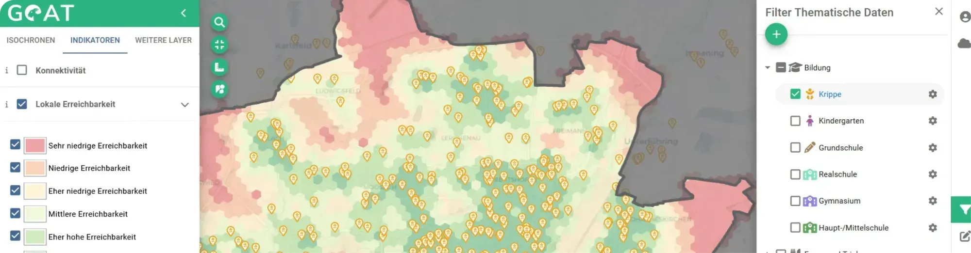
- Location analyses of supermarkets, childcare facilities, etc.
- Connectivity analyses of new residential areas
- Location of new mobility stations
Overview
In the context of the GOAT 1.0 development project, the GOAT planning software was developed from a prototype to a mature version 1.0. Both the user interface and a large number of functionalities were refined in the process. The development took place in a co-creative process, in close cooperation with the municipalities of Fürstenfeldbruck, Freising and Munich. During the project, GOAT was used by local planners to evaluate the effects of new path connections and to check the distribution of amenities of daily need.
Planning of new cycle path connection at Giesinger Berg
Goal
Our project goal was to improve GOAT and incorporate new features tailored precisely to practical needs. After a year, the project has been completed, and here are some selected examples of the new features:
- Bicycle routing
- Creation of land use scenarios , including adding, deleting or adapting POIs (e.g. placement of a new kindergarten) and buildings (e.g. modelling how well a new residential area is supplied with daily needs)
- Mapillary Street-View photos that help users understand the local situation and identify vulnerabilities
- Display of a variety of spatial data sets , such as environmental data, accident data, mode share (only for Munich), quality of the road network (crossing options, perceived cycle path quality assessed by MunichWays , speed limits, etc.) and land use data (from ATKIS and OpenStreetMap)
- Enabling data import and export
- Improved usability
- Numerous back-end improvements
Collaborative Development & User Feedback
After an intensive initial development phase, three test cycles were conducted in Fürstenfeldbruck, our development partner. Each test cycle included a workshop with five to six local users from the fields of transportation and urban planning. During these three test cycles, participants were able to familiarize themselves with GOAT and gain their first practical experience with it. They also provided valuable feedback and made constructive suggestions for improvement. The features were improved after each test cycle, allowing participants to test a new and improved version of GOAT at each workshop.
More information about this project:
Our Blogpost: Release 1.0
Accessibility to supermarkets in Fürstenfeldbruck Accessibility to childcare facilities in Munich Planning of new cycle path connection at Giesinger Berg
If you liked this, take a look at
GOAT 3.0
Development of new GOAT functionalities for public transport planning, green space planning, essential services, and the 15-minute city.
Read the referenceHave a research project that needs this?
Book a slot and we will talk through what GOAT can already do and what it would take.
Ready to make sense of your data?
Join planners, organizations and cities using GOAT to make better decisions, faster. No GIS expertise needed.