Plan4Better

Industries

Healthcare

Healthcare access is unequal, and the gaps are growing. Identifying disparities, planning facilities in the right locations, and ensuring vulnerable populations are served are fundamentally spatial challenges. GOAT gives health planners and public authorities the tools to analyse access to medical care with precision and build a clear, evidence-based case for action.

GOAT healthcare dashboards for analysis, planning and reporting for private and public sectors
Patient travel-time accessibility to hospitals, GPs and pharmacies in GOAT

Map Patient Access to Hospitals, GPs & Pharmacies

Calculate how well patients can reach hospitals, GP practices, pharmacies, specialist clinics, and care homes by different modes of transport — on foot, by bicycle, by public transit, or by car. GOAT's isochrone and travel time analyses identify underserved areas and support evidence-based decisions about where new facilities are most needed.
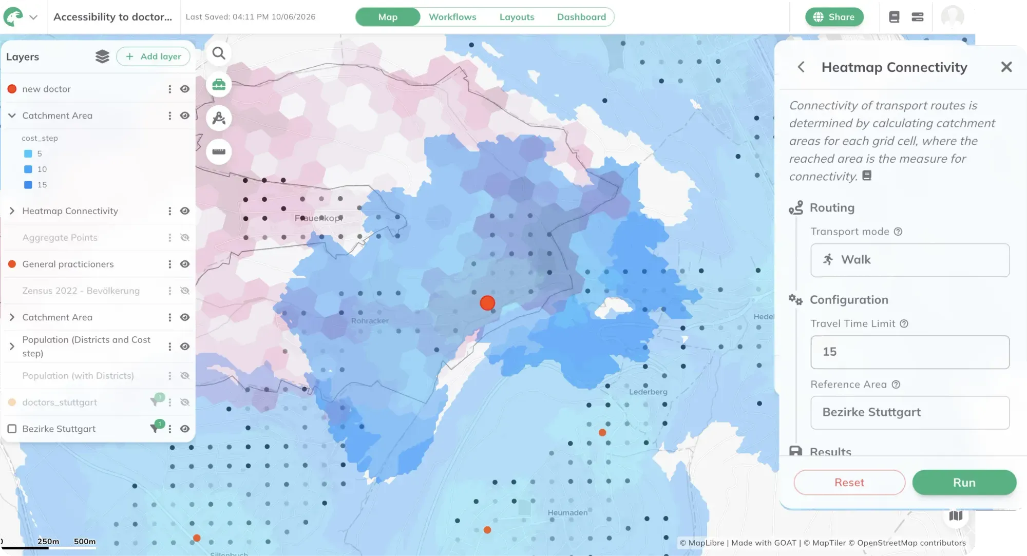
Site suitability analysis for a new medical facility in GOAT

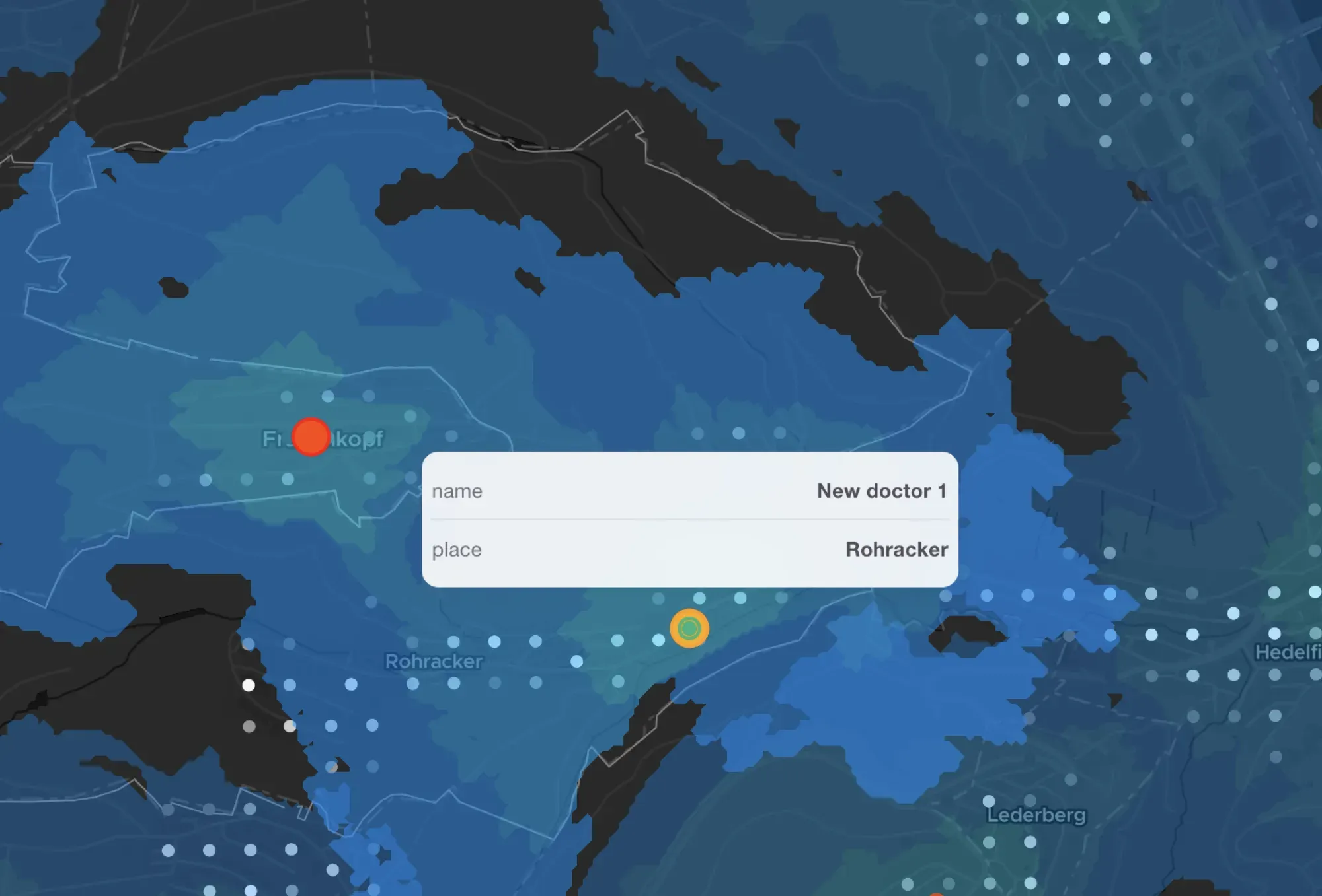
Identify Optimal Locations for New Medical Facilities

Evaluate the spatial suitability of locations for new medical facilities based on population density, demographic structure, existing provision, and multimodal accessibility. GOAT enables planners to compare location options systematically — providing a robust, data-driven foundation for investment decisions and planning applications.

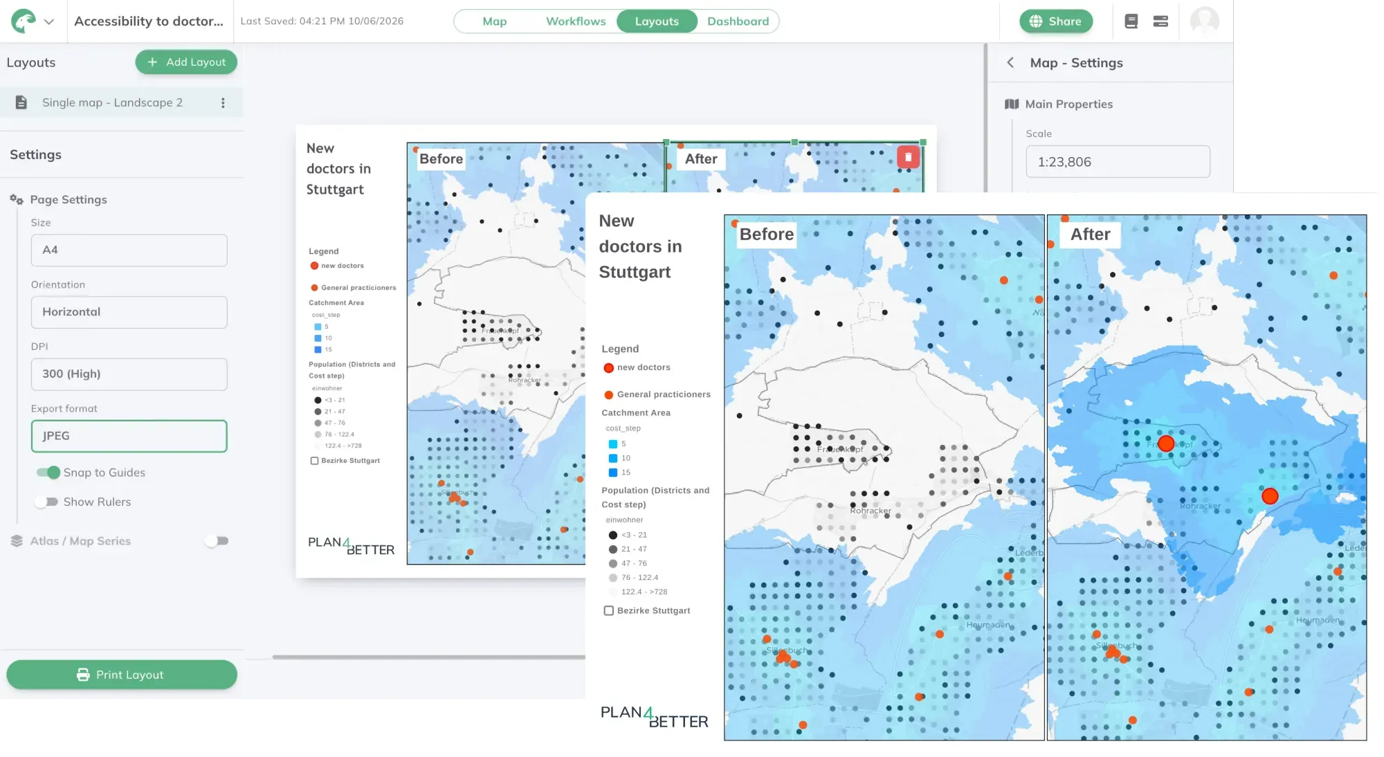
Print-ready healthcare provision report built with GOAT's Layouts tool

Turn Analyses into Reports for Planning & Approval

Move from analysis to a finished document without leaving the platform. GOAT's Layouts tool turns maps, accessibility results, and catchment analyses into print-ready reports — for healthcare planning committees, public participation, or applications to regulatory bodies. Add titles, legends, scale bars, and explanatory text, then export polished PDFs or PNGs that make the evidence behind a decision clear to non-specialist stakeholders.

Maps made with GOAT

Real analyses built by planners, researchers, and cities — explore what’s possible before you start your own.

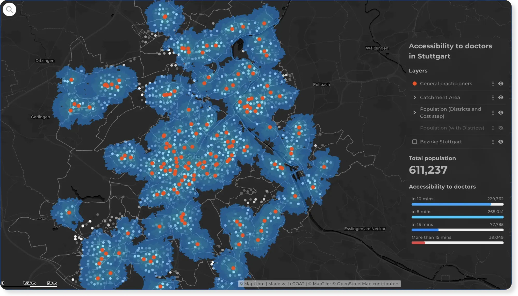
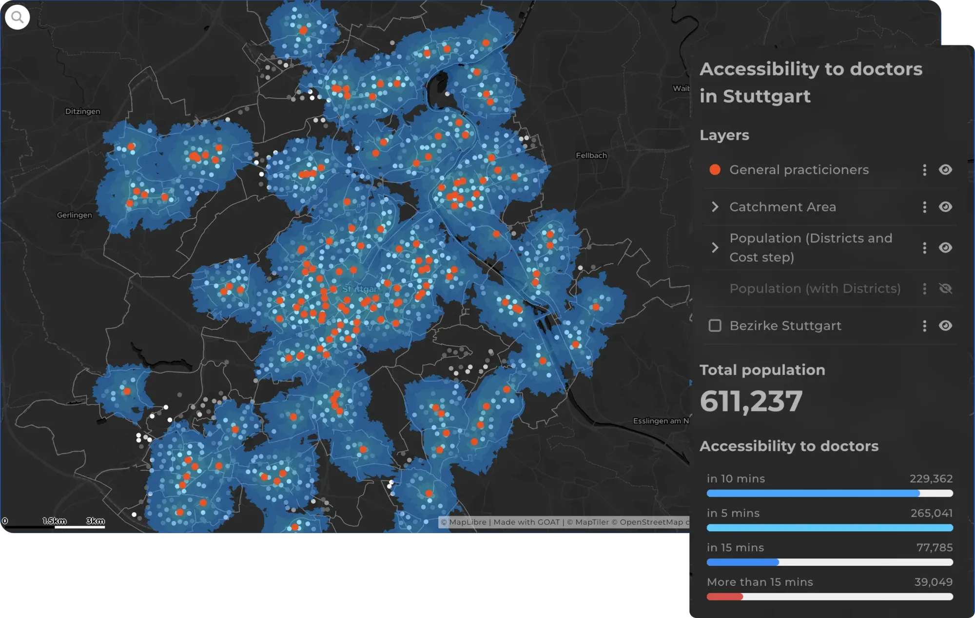
  • How Easily Can Stuttgart Residents Reach a Doctor?

    How Easily Can Stuttgart Residents Reach a Doctor?

    Reaching a doctor shouldn't depend on where you live. This map shows travel time to GPs across Stuttgart, reveals the areas left underserved, and suggests where new practices should go.

    Check the map

The difference

Why GOAT?

  • Planning indicators and GIS tools, ready and easy to use

    Travel times to practices, hospitals and rescue stations by car, public transport and on foot, plus gravity-based heatmaps that weight provision against population: the indicators coverage decisions rely on, ready to run with your parameters. Around them sits a full toolbox of GIS and data analysis tools, so you can join your own provider registers without leaving the browser.

    Then save the whole thing as a workflow. When the data updates or a boundary changes, run it again. Same method, new result, no rebuilding.

  • A data catalog with AI-powered search

    Over 20,000 ready-to-use datasets: population by age, settlement structure, street networks, administrative boundaries. Describe what you need and the catalog finds it, so you can start the analysis instead of procuring data first.

  • Ready to use, open by design

    Nothing to install. Built on open-source technologies and open standards, so your data and workflows stay portable.

  • Scalable

    From one district's on-call planning to state-wide coverage assessment.

  • Proven in practice

    Used by public health authorities and service associations in Germany.

See how MOBITAT is doing it

How much of each municipality's population can reach a category of destination by bike, across 520 municipalities.

Accessibility Analysis for project "MOBITAT"

Accessibility Analysis for project "MOBITAT"

Conducting accessibility analyses with GOAT for cycling and public transport for the 520 municipalities in the Frankfurt-Rhine-Main metropolitan region.

Read the reference

Planning healthcare provision in your region?

Book a slot and we'll look at your coverage and travel times together.

  • Routing and accessibility analyses to support licensing and coverage decisions.
  • Combine practice, hospital and rescue service data to plan on-call cover and emergency deployment.
  • Interactive maps for consulting conversations with members.
  • Map-based reports for mayors, district administrators and the Ministry of Social Affairs.

Ready to make sense of your data?

Join planners, organizations and cities using GOAT to make better decisions, faster. No GIS expertise needed.